On Day 3, we learned how storms work. Today we learned that storms are not always reliable.
In the morning we hurried up early from Colby, KS, to go to the Colorado plains. These plains seemed the most likely to create storms today, which basically means:
- The air needs to be moist so that clouds are shaped. This is usually supported by winds from the Gulf of Mexico
- A strong wind in the upper atmospheric layers that kind of stretches out the cloud so it doesn’t “choke itself”.
- A strong surface wind at the ground blowing at an angle to the upper winds. This “puts a spin” on the winds.
- Probably a lot more, but this is what I have learned this far 🙂
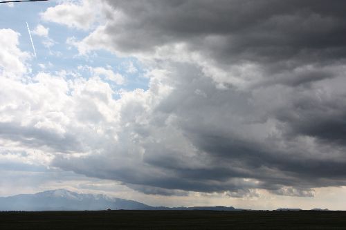
The air started bubbling pretty early in the afternoon (as it usually does near the Rockies) so we went out to some very promising and beautiful clouds.The sun was shining brightly upon them and with the Rocky Mountains in the background, it was a fantastic sight! The storm started growing some but quickly dissipated as a hissing balloon so we went back to our base camp in the area – a small shopping center.
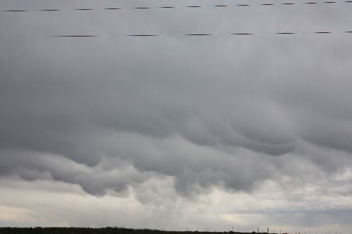
We waited a while in the shopping center and later went out to some new promising objects. That storm split up into a northern and southern cloud and we bet on the south one – which typically is the best choice – but it also died out. Instead we saw, to our frustration, on the radar that the northern one blew up instead. It was going 30 mph and was already at some distance so there was no chance to catch up with it. We went after another cloud a bit half-heartedly, but then gave up and went back to our base camp again.
It really is not easy to chase storms. The conditions can be there but still not be optimal. This year, the weather conditions have been generally poor, but improved bit-by-bit since the beginning of our tour. Even if the conditions are good, not all storms mature into a supercell / tornadic state.
Another problem when you chase storms – and something that requires a lot of experience – is positioning yourself for the storm. You want to be positioned a bit on the front edge of the storm but driving there is not always as easy. A basic problem is that the storms like to go southeast and the roads either south or east!
In rural areas you can sometimes be driving north, north and further north when all you want to do is take a turn westward over the fields! Another problem, especially evident in Colorado, is that even if the Midwest is flat, there’s always some hills and if you are in the valley between the hills you don’t see very much of the storms.
Well, in anticipation of possibly going out again late in the afternoon, we gave up a bit and sat in the rear of the best-equipped van, bought some local beer and looked at the movie Attack of the killer tomatoes.
Two boring days in a row now, and it shows in the group where some are starting to get a little bit frustrated.
Some pictures from the day: