I woke up early (why is jetlag always worst the second day?!) only to realize we had been having a 7th passenger in the vehicle yesterday! Buried between two toes I had a tic. This was just 24 hours after Peter’s morning briefing about safety and spraying your feet with bug spray to avoid…tics. Yuck.
The first two days had been much about getting my cell phone data working. I used up $50 worth of data only in Dallas Airport in like two minutes (roaming costs are insaaaane!). It ended up being an extremely annoying task. I had a prepackaged sim-card from a previous trip that didn’t work and purchased another eSim (from RapideSim) that didn’t work either. It took me almost 5 hours of troubleshooting until I finally got it working! Although it would be nice to have some phone/computer detox during this vacation, having data is quite crucial.
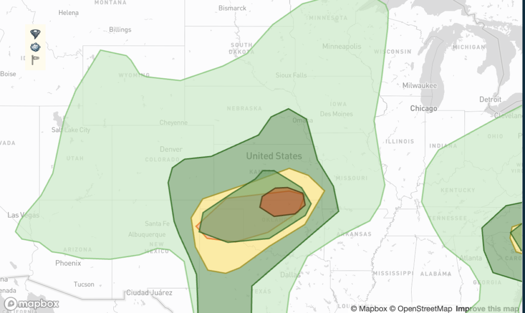
After getting rid of the free passenger and fixing the data issue I was ready to get going and today looked a lot better than yesterday. SPC had a 5% tornado risk (that eventually was downgraded to 2%) despite pretty bad dew point spread profiles. The target area was north central Oklahoma.
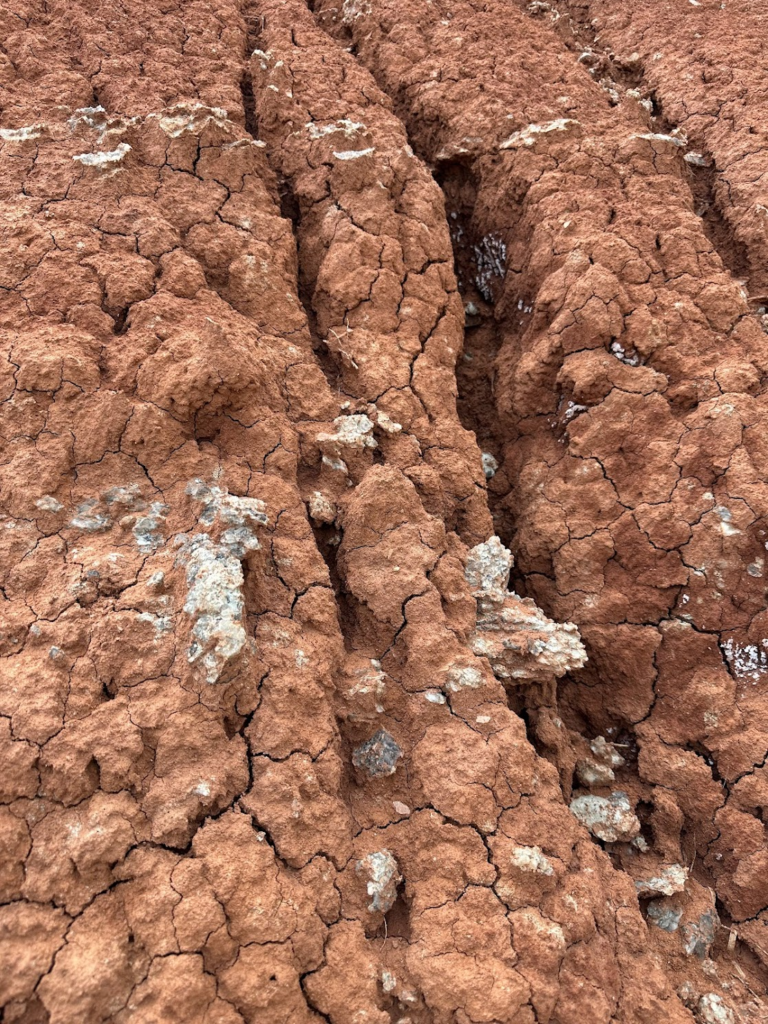
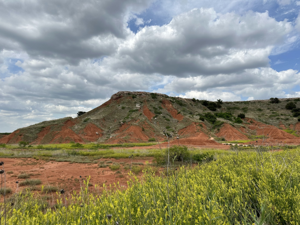
One nice habit Peter Wharton of StormGroup chasers have is to avoid having lunch in restaurants and instead drive by Walmart so everyone can pick up some food, and then go to a place with a nice scenery to have a picnic. Yesterday, we spent a lovely day at the Boiling water park in Oklahoma and today we stayed by the Glass mountain (also Oklahoma).
My son is totally into rocks at the moment and as most parents know: when your kids get into a subject, you are bound to join in as well. So, I was quite excited to look at all the cool rocks (that looks like broken glass).
Initiation seemed to be around Medford, OK, so that’s where we headed. As always, when you get to a target area gas station it is a bit of a social event. I was happy to meet up with the crew from Extreme Tornado Tours as well as Roy from my chase last year, which was really cool.
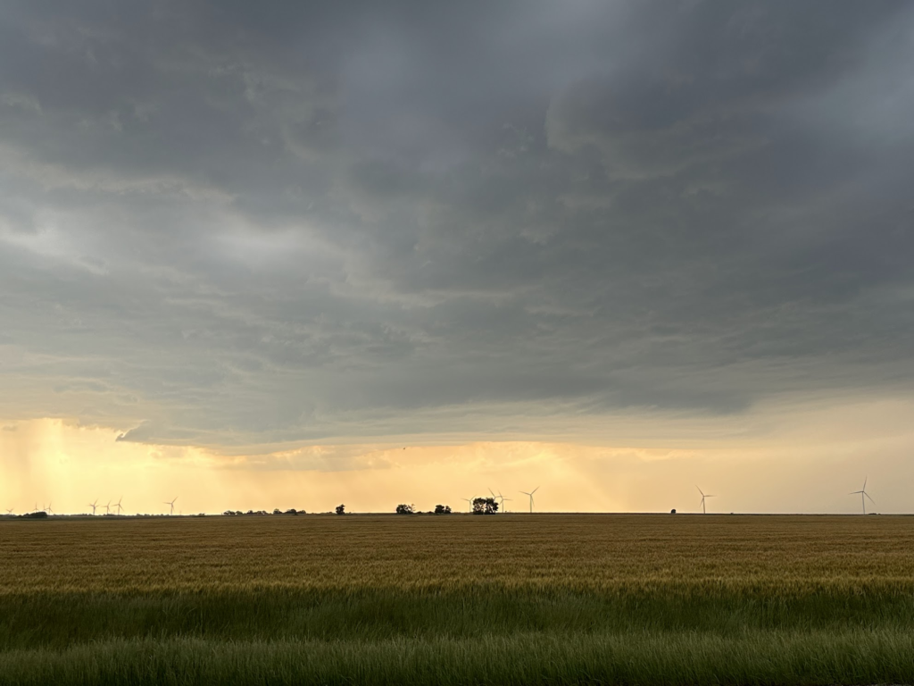
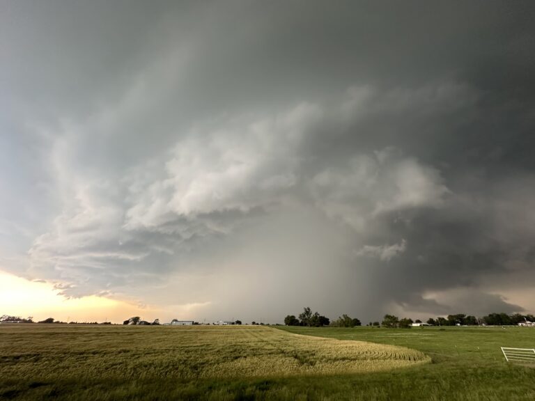
When a storm finally fired we went out and this day was about to overdeliver again. Being perfectly positioned we could watch the storm mature into a supercell and slowly approach us. The limiting factor of the day was that storms were going to be high based and this was no exception. It did however form a rather rapidly rotating wall cloud that we allowed to pass right over us, and it was an amazing sight to see!
The wall cloud as it was coming in over us
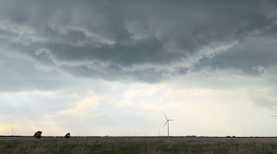
Usually, having a rotating wall cloud pass over you is not a safe procedure but the tornado threat was quite small so it was a unique opportunity to glance into this turbulent, rotating mass. I was awe struck! Knowing that the tornado potential was low, I didn’t have that semi-frustrated feeling of “C’mon, pleeease form a tornado” either, and could just enjoy it for what it was.
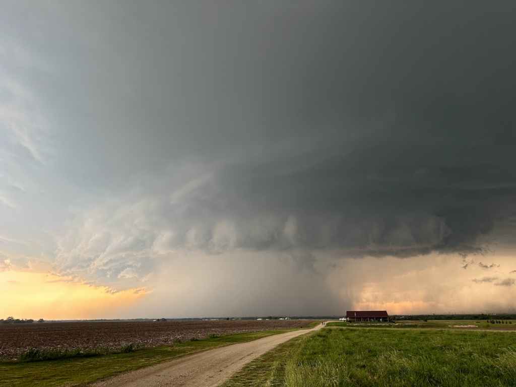
In order to avoid the dirt roads, we had to take a bit of detour around the storm but finally had it coming against us, with a steadily increasing storm rotation but also getting more rain wrapped. We got a couple of more really nice stops to watch the monster hailer of a supercell come at us around Ponca City, OK. It was an impressive sight!
The eastbound roads ended pretty much as the daylight was coming to an end so we called the day off at sunset and went back to Enid. Tomorrow’s targets looks like Texas so we have to get up early.


