Today was quite a classic day of Storm Chasing. We woke up, had breakfast / brunch at Ihop and by then our guides Charles had made a plan for today’s trip. They look at their radar images, listen to weather reports, look at their gadgets and make estimates where it is most likely that the super-cells and tornadoes will be created.
Today, it seemed to be western Oklahoma and north-western Texas, so we started moving in that direction. Charles has access to local radar images on his laptop that enables him to analyze the storm clouds around. On it he will look for emerging clouds that show the right features.
Today we passed a number of smaller cells on the way down through Kansas, but none looked really interesting. Instead, we focused on a double cell being formed in north-western Texas and sped on southwards. On the way down there we drove past another cell which at first did not seem interesting at all, but began shaping up really quickly.
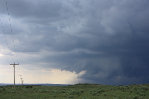
What happens when a storm cloud begins to mature is that it is rising up quickly and starts to spread at high altitude. If the rotation is strong enough this can be seen on the radar. When you then start to see a “wall cloud”, that’s when it starts to get really interesting.
This very day outside Canadian, Texas, it was just like this. A wall cloud began to emerge from the cloud and created formations of small clouds down toward the ground. If a wall cloud starts to rotate, it can produce tornadoes.
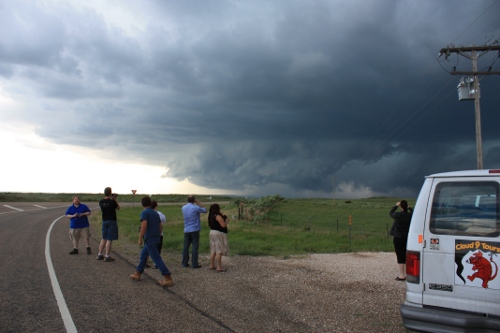
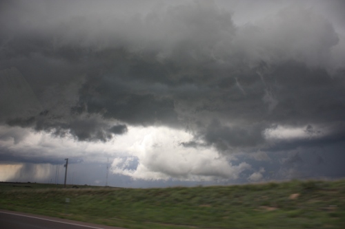
A really large storm cell is called super-cell and is a magnificent sight. Our storm cell developed into one and we drove through it at the small village of Canadian, TX. Rain and hail poured down, and the clouds seemed like they were just some 100 meters above. When you also know that the roof basically can start to spin into a tornado at any time, your pulse really goes up a few notches!
We went out on the other side of the base and then kept ourselves just outside this low wall cloud. The storm created quite frequent lightning and when the wall cloud silently floats in and over you, it is just plain powerful. It looks very much like when the mother ship in Independence Day floats over the sky!
Absolutely amazing!
Photos from the storm: